Fire behavior Sunday was not as active as previous days. Moderated fire conditions led to minimal perimeter growth.
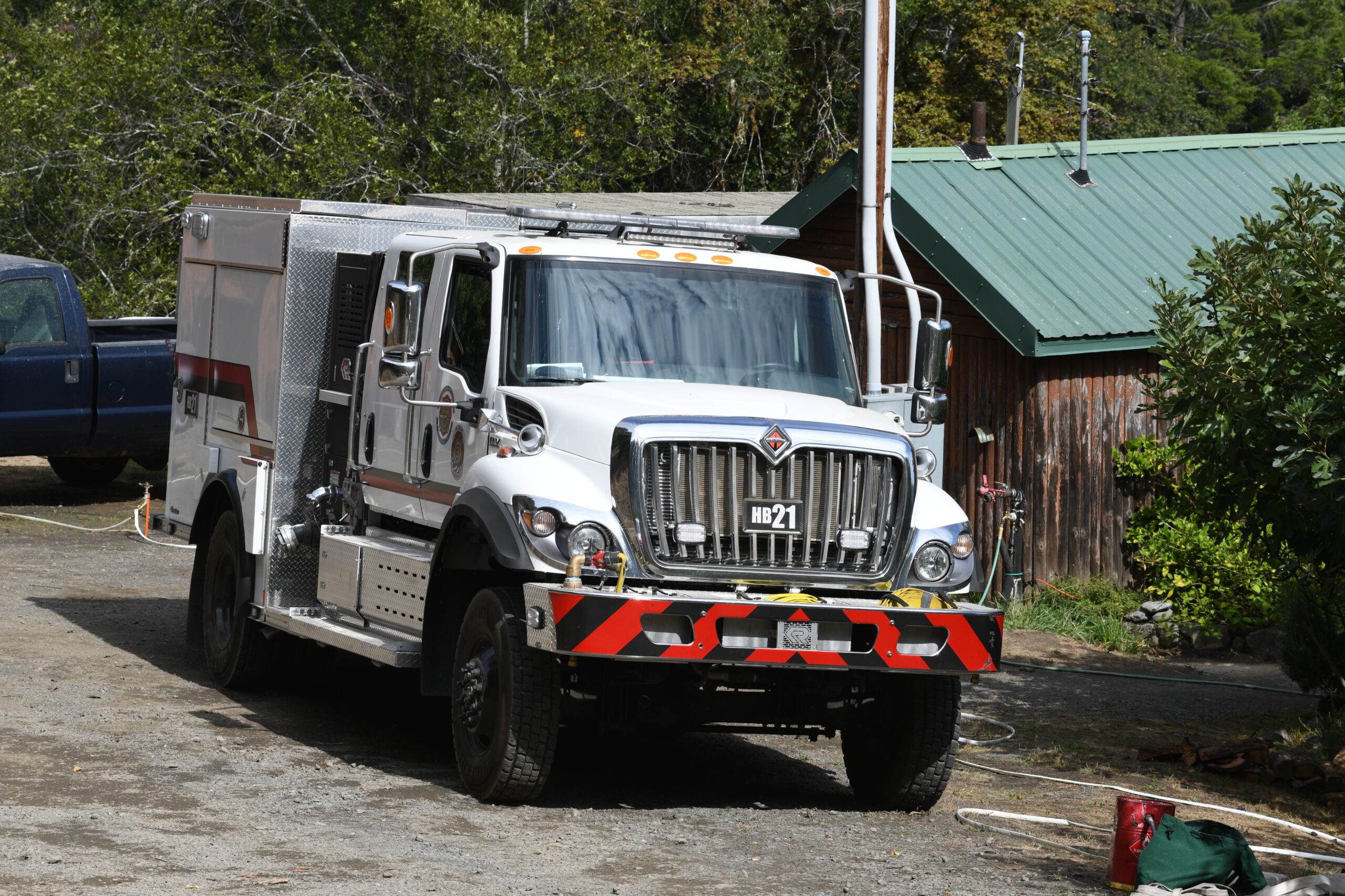
The Oregon State Fire Marshal has six structural task forces assigned to the fire. These task forces are working to protect approximately 125 threatened homes in the Illahe and Agnes communities. One outbuilding near Clay Hill Lodge has been lost.
Ground resources completed line and plumbing around two spot fires on Panther Ridge Sunday. Plumbing is a system of hoses, valves and tanks that deliver water to areas without developed infrastructure. Crews also completed prepping and wrapping Bald Knob Lookout.
Along the river corridor, crews finished prepping and installing sprinklers around Marial Lodge and Rogue River Ranch. To the southeast, firefighters are working to build indirect and contingency lines to catch fire that crossed Bear Camp Road.
Aviation resources flew 38 hours, dropping 198,000 gallons of water to support operations across the fire area.
A status update about the fire will be livestreamed on Facebook at 6 p.m. Saturday on the Southwest Oregon Fire Information Facebook page, www.facebook.com/SWORFireInfo/. A Facebook account is not required to view the link.
WEATHER: High temperatures will be in the 60s today, with rain likely this morning and potential for scattered thunderstorms throughout the day. Winds will be out of the southwest, with gusts up to 15 miles per hour.
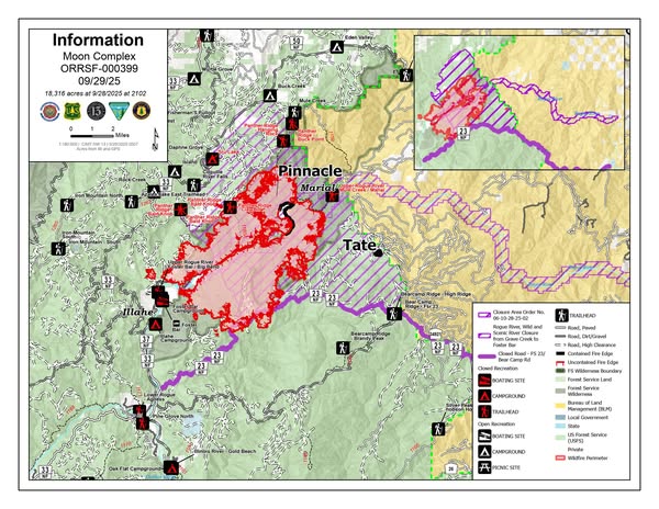
EVACUATIONS: A Level 3 (GO NOW!) evacuation order is in place from Tacoma Rapids (River Mile 29) to the Oak Flat area, including Agness. A Level 2 (SET!) evacuation order is in place southwest from Spud Road and the Rogue River, bordered on the northwest by Forest System Road 33 (Agness Road) and ending at Forest System Road 3318. An interactive evacuation map can be found at https://bit.ly/MoonComplexEvacs. The American Red Cross has opened an evacuation shelter at First Baptist Church, 29755 Turner St., Gold Beach. Evacuation levels will be assessed daily.
SMOKE: Air quality is moderate to unhealthy across many areas in western Oregon. Smoke and air quality information is available at https://www.oregonsmoke.org/ and https://www.airnow.gov.
CLOSURES: Bear Camp Road, Eden Valley Road, Forest System Road 2308, and Forest System Road 33 from Agness to Powers are closed. The Rogue River-Siskiyou National Forest is implementing an expanded closure area to protect public and firefighting safety and to ensure firefighters have safe access to the Moon Complex. Lands, roads, trails and recreation on the Rogue River are closed in this area. Please visit: https://www.fs.usda.gov/r06/rogue-siskiyou/alerts for closure information and maps. River-based recreation is closed on the Rogue River from Grave Creek to below Agness. No river permits are being issued at this time. The Rainie Falls Trail and the Rogue River Trail from Grave Creek to Marial are open.