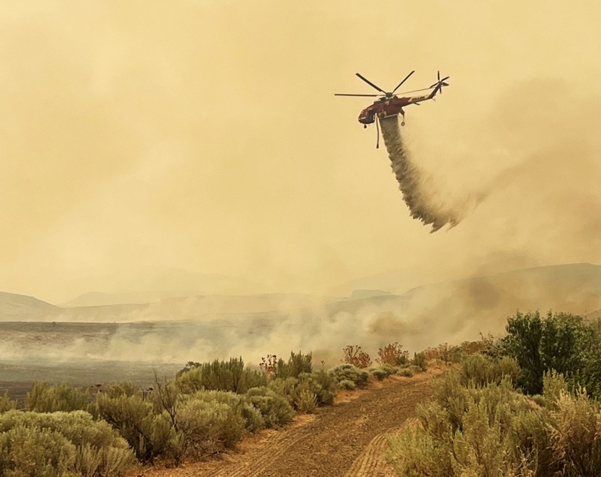
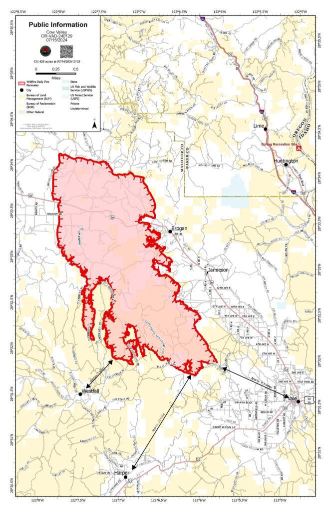
Firefighters are working around the clock to stop the Cow Valley Fire in Malheur County. There is currently a day shift, swing shift, and night shift operating as fire conditions allow. The fire is 132,528 acres. Most of the fire growth was wind driven and occurred on the western edge towards East Prong Dry Creek. Sunday, firefighters continued to create line around the fire on the northern, eastern, and southern edges. Aviation resources dropped water and fire retardant on the western edges of the fire, slowing the rate of fire growth. The current perimeter around the fire is 163 miles long. Fire edges remain south of the Malheur Reservoir, east of Brogan and Jamieson, and north of Bully Creek Reservoir.
The Oregon State Fire Marshal task forces continued to work on structure protection efforts in the communities along Highway 26 and in Westfall—in addition to assisting firefighting efforts on the southern edge of the fire. The threat to the local community has significantly decreased and the number of wildland firefighters on the incident have increased. For that reason, the Oregon State Fire Marshal has begun to right size resources on the Cow Valley Fire. One task force was demobilized yesterday. Today, two task forces will continue to support structure protection on the Cow Valley Fire and two will be sent to emerging fires across the state.
QUICK STATS
Location: 9 miles east of Ironside, OR
Total personnel: 362
Fire size: 132,528
Cause: Human caused, under investigation
Containment: 0%
The fire burned throughout the Sunday night. Winds died down around 3:00 a.m. This, in addition to higher humidity levels and lower temperatures, allowed night crews to continue their progress. Monday, firefighters will explore options on the southwestern edge to connect the leading edges together. Resources in other areas will strengthen and secure fire lines around the perimeter using tactics known as cold trailing and mop up – where they use tools and water to extinguish heat. Firefighters will also work with aviation as weather allows.
An Unmanned Aerial System, also known as a UAS or drone, with infrared technology will be used during day and night shifts to monitor for hot spots that threaten the integrity of the fire line. The UAS could also be used for strategic firing operations if needed.
WEATHER AND SMOKE: Today’s temperatures will be slightly cooler with a forecasted high of 96 degrees Fahrenheit and slightly higher humidity levels. Extreme fire behavior is still possible based on fuel and weather conditions. Winds will be moving east at 5-8 mph, with gusts up to 15 mph.
Smoke from neighboring fires will drift towards the area with the wind. For the current smoke information and the air quality index, visit airnow.gov.

