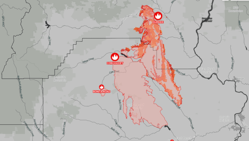
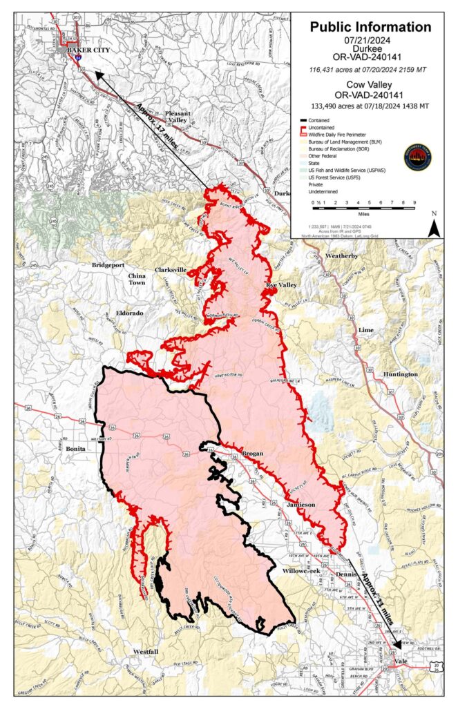
Saturday was an extremely active fire day. The Durkee Fire spread rapidly to the southeast, with some growth in the north and west. About 24 aviation resources engaged in aerial firefighting operations over Durkee Fire throughout the day, one of the largest aerial responses in the country. There was an intrusion into the restricted air space from a privately owned drone. Thanks to the quick actions of fire personnel, aircraft did not have to be grounded and firefighting efforts were able to continue both on the ground and in the air.
Firefighters conducted strategic firing operations on the southern tip of the fire up Dry Creek Road. This helped create a fire break to slow fire spread. Firefighters have been able hold the fire from Brogan south. The Durkee Fire did spread to Malheur Reservoir last night.
QUICK FACTS
Start date: July 17, 2024
Location: 5 miles southwest of Durkee
Fire size: 116,431 acres
Containment: 0%
Personnel: 434
Cause: Lightning
Durkee Fire acreage and map are as of 11:59 p.m. on July 20.
On Sunday, extreme fire behavior is anticipated again. Firefighters, in partnership with local Rangeland Fire Protection Associations, will engage and make progress around the fire perimeter where it’s safe. They are working on building fire line from Malheur Reservoir to Amelia Butte. Firefighters are also working to slow fire spread where the fire crossed Burnt River. A weather shift is expected today.
WEATHER AND SMOKE
There is a Red Flag Warning for lightning today. Thunder is expected outside the fire area to the south. The thunderstorms will bring outflow winds tonight and could cause gusts up to 60 mph from any direction. For current smoke information, visit airfire.org.
EVACUATIONS AND CLOSURES
The Malheur County Sheriff’s has issued evacuations for the area around Durkee Fire. check for updates on the Malheur County Sheriff’s Office Facebook page.
The Baker County Sheriff’s Office has issued evacuations for the area around Durkee Fire. Visit the Baker County Sheriff’s Office Facebook page for more information. The Baker County Sheriff’s Office has closed Burnt River Canyon Road to non-local, non-emergency traffic because of the Durkee Fire.
BURN BAN
A burn ban is in effect for Malheur County, including all BLM lands. For more information, visit https://www.malheurco.org/category/public-notices/.
TEMPORARY FLIGHT RESTRICTION
There is a temporary flight restriction over the Durkee Fire; please remember, if you fly we can’t!
Durkee Fire Incident Website
Fire information phone number: 541-208-4371, staffed 7 a.m. to 7 p.m. PDT
Fire information email: 2024.durkee@firenet.gov

