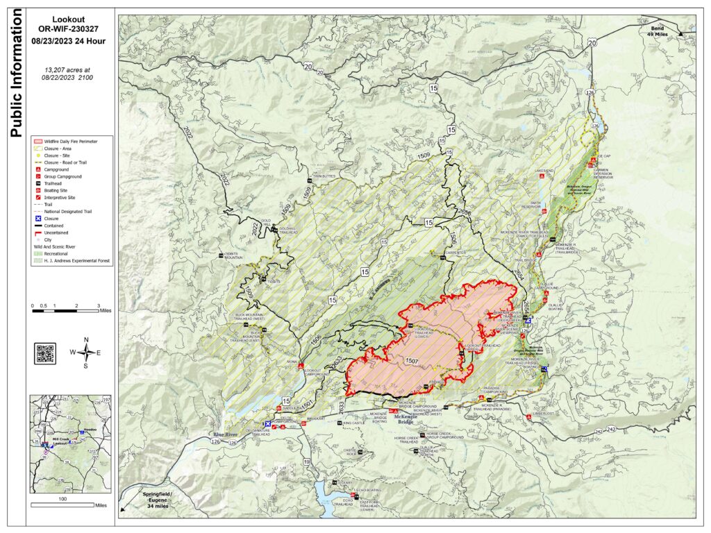
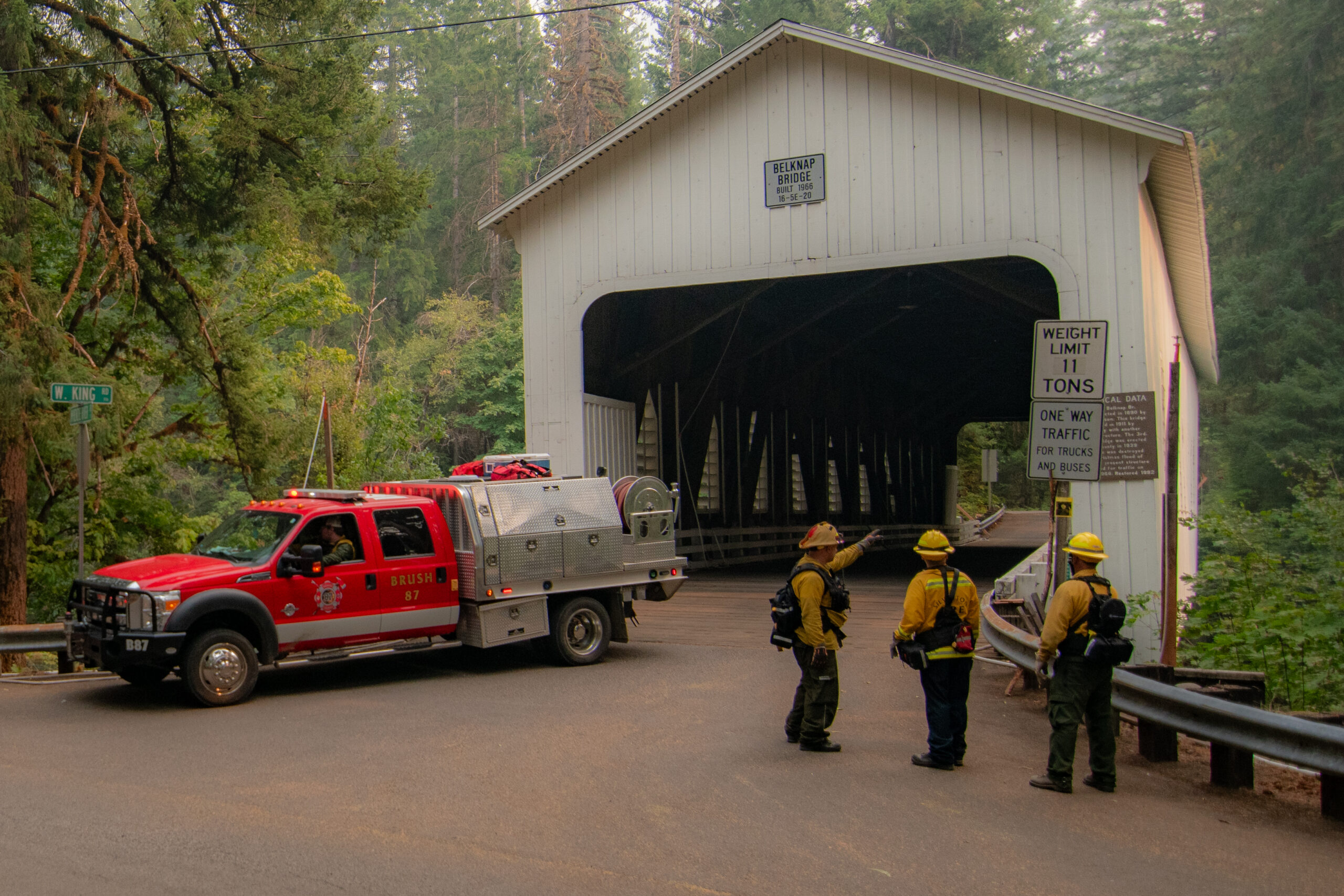
The Oregon State Fire Marshal (OSFM) resources assigned to the Lookout Fire in Lane County are demobilizing this morning and returning to their home agencies. Structural task forces from Clatsop, Tillamook, Lane, Clackamas, Deschutes, Yamhill, and Marion counties, as well as from the California Office of Emergency Services (Cal-OES), responded to this fire. The OSFM task forces assessed 1,023 structures and prepped 560 more for protection while assigned to the Lookout Fire.
A community meeting will be held, Wednesday, from 5:30-6:30 p.m. at McKenzie River High School. The meeting will be broadcast on the Lookout Fire Facebook page at 8 p.m.
QUICK FACTS
Size: 12,368 acres
Start Date: August 5, 2023
Cause: Lightning
Containment: 6%
Point of origin: 3 miles north of McKenzie Bridge, OR
Total personnel: 1,213
Resources: 72 engines l 23 crews l 14 bulldozers l 31 water tenders l 11 masticators l 6 helicopters
OSFM Resources: 5 task forces assigned to structure protection divisions
Fire behavior was moderate at the Lookout Fire on Tuesday with the exception of several spot fires across Deer Creek Road on the fire’s northeast flank. Hand crews and engine crews are making progress containing the spot fires, assisted by water-dropping helicopters.
Gusty winds from the west cleared dense smoke lingering over the area yesterday, giving way to clear skies and improved visibility for air operations. A warming trend will begin today with critical fire weather and a chance of thunderstorms forecasted for Thursday.
In the higher elevations along the northwest flank, yesterday’s cooler temperatures and higher humidity inhibited burning operations intended to secure Road 2633 (Mill Creek Road). Firing operations will progress in this area today and along the fire’s southeast flank in more favorable burning conditions. Above the fire’s northern flank, crews with heavy equipment including bulldozers and masticators are clearing hazardous trees and vegetation along roads, preparing for burning operations to prevent the fire’s spread to the north. On the fire’s southern flank, firefighters are progressing with mop-up along Road 700m working to the east.
The rapid management of this fire would not have been possible without the quick actions of local resources, the support of the community, and the hard work of our response partners. Wildland resources remain in place and continue to provide structural protection if necessary. Local agencies continue to provide protection to the impacted communities and the OSFM resources remain available to return to the area should the need arise.
EVACUATION CENTERS: An evacuation center is in place at Lowell High School for evacuees and small pets from the Bedrock and Lookout Fires. A large animal shelter is set up at the Lane County Fairgrounds in Eugene.
EVACUATIONS: In Lane County, there is a Level 3 (Go Now) evacuation notice for North Bank Rd., all areas north of Highway 126 between North Bank Rd. and Drury Ln., Mona Campground, Lookout Campground, H.J. Andrews Headquarters and the area west of Highway 126 from Scott Rd. north into Linn County.
There is a Level 2 (Be Set) for areas north of Hwy. 126 west of the .5 mile mark on Mill Creek Rd. to Blue River Reservoir Rd. at the 1501 junction, the areas north of Hwy. 126 east of the .5 mile mark on Mill Creek Rd. to the east end of Taylor Rd, the area south of Hwy 126 to the McKenzie River from the east end of McKenzie River Dr. to the McKenzie River Bridge just east of Taylor Rd, Highway 126 from the Highway 242 junction to Scott Rd, Paradise Campground, FS Rd. 302, Belknap Springs Rd, the area east of Highway 126 from Scott Rd. north into Linn County.
There is a Level 1 (Be Ready) evacuation notice for areas south of Hwy. 126 from Blue River Reservoir Rd. east to the east end of McKenzie River Dr, McKenzie River Dr., and areas directly to the south and east, The area south of Hwy 126 from the McKenzie River Bridge just east of Taylor Rd. to Scott Creek Rd, Belknap Springs Rd. S, Hwy 242 to FS Rd. 220, Yale Ln, Camp Yale Rd, FS Rd. 2643 southeast to the 445 spur.
Lane County evacuation updates
In Linn County, there is a Level 3 (Go Now) for Olallie Campground, Trail Bridge Reservoir & Campground, and the trail systems and roadways north of the Linn County line, and west of Highway 126, extending north to the intersection of National Forest Service Road 730 and Highway 126.
A Level 2 (Be Ready) for the area from the east side of Olallie Campground east to the Willamette National Forest Boundary, north along the boundary to Ice Cap Campground and Trailhead, then west to encompass Lakes End Campground and trail system, and south in line with the intersection of National Forest Service Road 730 and Highway 126 (entrance to the Carmen-Smith Hydroelectric facility). Tamolitch Falls/Blue Pool and Smith Reservoir are within this Level 2 (be set) evacuation zone.
Level 1 (Be Ready) evacuation zone for areas north of Ice Cap Campground, extending east to the Willamette National Forest boundary, and north in line with Highway 20. This includes all areas around Clear Lake and Clear Lake Campground. For current information: https://www.linnsheriff.org/2023/08/lookout-fire-update-august-17-2023-330-p-m/
CLOSURES: Highway 242, McKenzie Highway, is closed between milepost 61-76, 14 miles west of Sisters, Oregon to just east of the junction with Highway 126. Highway 126 is currently open. Please monitor Trip Check for updates at: https://tripcheck.com/
Willamette National Forest closures can be found at: https://www.fs.usda.gov/detail/willamette/alerts-notices/?cid=fseprd552029Restrictions:Fire Restrictions are in place on the Willamette National Forest: https://www.fs.usda.gov/willamette
SMOKE OUTLOOK: Available at: https://outlooks.wildlandfiresmoke.net/outlook/4c92bc1a


