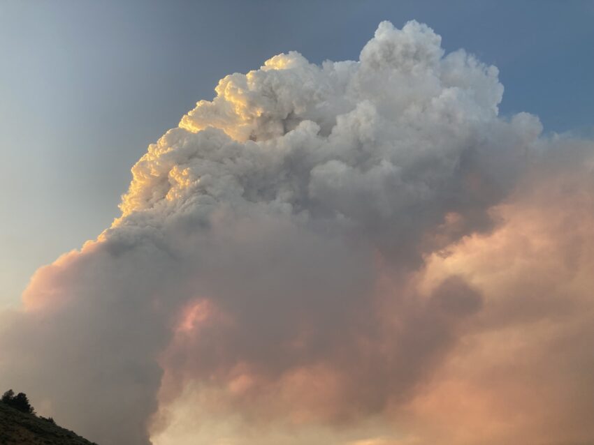
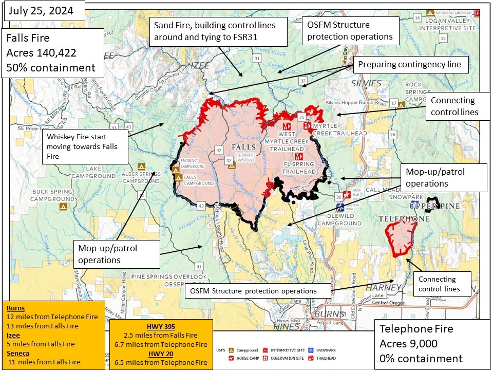
Despite strong, unpredictable winds from thunderstorms, firefighters managed to maintain control lines on both the Falls and Telephone fires. On Wednesday, task forces and wildland firefighters swiftly responded to several new fires, likely sparked by lightning in the early afternoon. Crews from the Oregon State Fire Marshal were strategically positioned to protect structures on both sides of the highway with additional personnel safeguarding the southern edge of the Telephone Fire.
Thanks to the extensive preparation and coordinated efforts of structural and wildland teams, the risk to structures is significantly reduced. Control lines were reinforced, and comprehensive mop-up operations were carried out. Consequently, the OSFM will start reducing their resources, allowing them to be available for other fires in Oregon. Thursday, task forces from Douglas, Tillamook, Clackamas, and Washington counties will be demobilized, while five OSFM structure groups from California and Washington will remain on site. Local resources will also be on standby for any structural responses needed.
The Northwest Incident Management Team will hand over command of both fires to Alaska Team 1 at 6 a.m. tomorrow.
Falls Fire Operations
On Thursday, crews will focus on holding and mopping up the northwest corner of the Falls Fire, working below Burnt Mountain along Forest Service Road 4785 near Coral Creek and further east to Forest Service Road 47. Efforts will continue to connect the fire line back into Forest Service Road 3150 in the northeast corner, preparing it as a control line for tactical burnouts.
The northeast corner of the fire remains active. Firefighters are working to secure areas near Forest Service Road 31 south of Myrtle Park Meadows and mitigate risks to structures in the Gold Hill and Silvies Valley areas. Patrol and mop-up operations will persist along the southern half of the fire perimeter, while construction of a secondary contingency line continues further north along Forest Service Road 37, west of Hwy 395 in the Fisk Gulch area.
Telephone Fire Update
Despite thunderstorms and high winds, crews successfully constructed and maintained control lines around the Telephone Fire. Lines have been established on the west flank along Forest Service 2820, to the north along Forest Service Road 480, and east along Forest Service Road 28. On Thursday, crews will continue to secure these lines and work on establishing a control line on the southern end of the fire. Aerial resources will be available to support suppression efforts, and structural crews will reassess previously prepped structures along the fire’s southern edge.
New Fire Activity
At least eight new fires have been identified within the Incident Management Team’s area of responsibility. Rapid response has kept most of these fires small. The largest, the Whiskey Mountain Fire, is approximately 1,300 acres, while the Sand Fire covers about 540 acres. Efforts are underway to prepare structures and establish control lines around these new fires, particularly in areas north of the Falls Fire and near Sand Mountain.
Southeast of the Telephone Fire, the OSFM deployed night shift resources to assist local teams with a new start off Cow Creek. Fortunately, this fire was quickly brought under control, mitigating the threat to nearby structures.
Through diligent work and strategic coordination, the firefighting teams are making significant progress in controlling these fires and protecting communities.
Weather
Cooler temperatures in the 80s are expected Thursday. Skies will generally be clear. Diurnal northwestern winds will change to the west and become breezier in the afternoon before returning to the northeast. Diurnal winds are the name for local thermal-driven wind cycles. There is a five percent chance of thunderstorms.
Evacuations
Evacuations remain in place in Grant and Harney counties because of the Falls and Telephone fires. For evacuation information, please visit the Harney County Sheriff’s evacuation map here: https://tinyurl.com/3zst4sjy, or the Grant County Emergency Management Facebook page: https://www.facebook.com/profile.php?id=100068819321423.
Closures
Due to active wildfires compounded by extremely unfavorable weather conditions, limited firefighting resources, and county resources, Malheur National Forest officials have temporarily closed lands within the Malheur National Forest.
Investigation
U.S. Forest Service fire investigators are seeking the public’s assistance with any tips or information pertinent to the start of the Falls Fire in the Malheur National Forest. Please submit any information that could assist fire investigation efforts to SM.FS.R6TipHotLine@usda.gov

