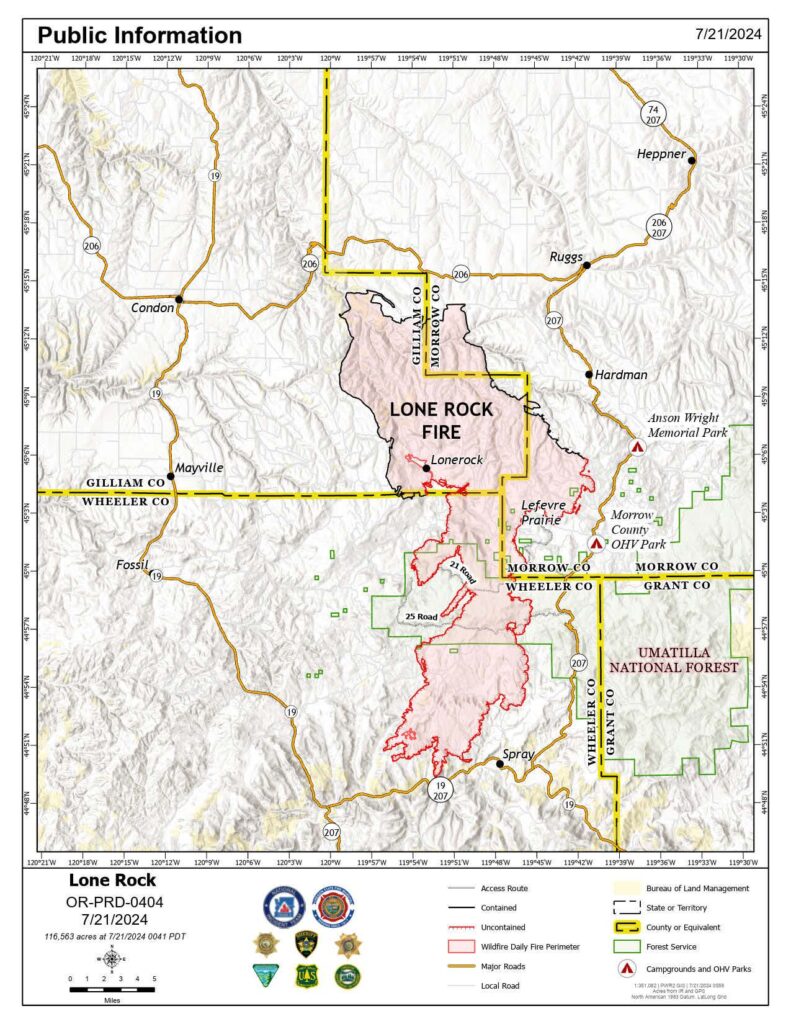
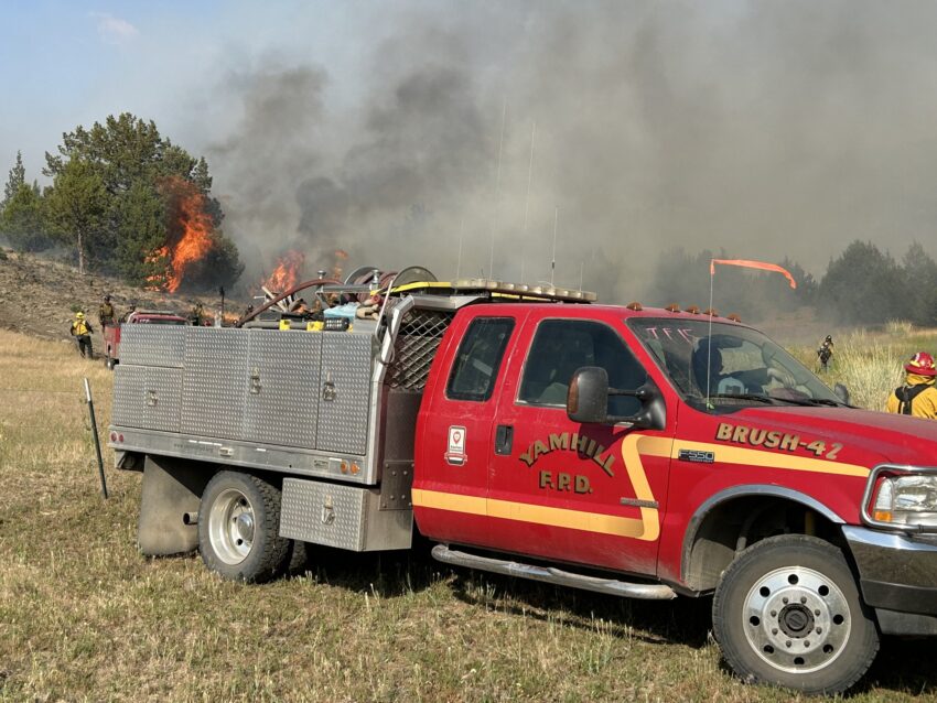
Sunday marks the second consecutive day of critical fire behavior on the Lone Rock Fire in Gilliam, Morrow, Wheeler, and Grant counties. Firefighters will be challenged with hot and dry conditions in the forecast. A forecasted cold front passage Sunday night could also create a chance of thunderstorm development, resulting in outflow winds having the potential to cause gusts that may drive the fire in any direction. Despite the adverse conditions, firefighters continue to make progress by using fundamental firefighting principles: anchor, flank, and pinch. Firefighters are using the fire’s easternmost point north of Morrow County OHV Park as an anchor point. Reinforcing this area with containment line is a priority to continue flanking south and making progress in controlling the fire.
Despite the active fire behavior in the Alder Creek area, the fire has not crossed Alder Creek. Another priority area is Kahler Basin Road where the fire is holding. Firefighters will focus on keeping the fire contained at Alder Creek and Kahler Basin Road. Recognizing that direct firefighting efforts have proven more effective, firefighters will continue to work directly on the fire’s edge whenever possible. With the continued critical fire weather conditions and extreme fire behavior expected again today, firefighters will maintain a keen sense of situational awareness to ensure firefighters can temporarily disengage for their safety.

The Oregon State Fire Marshal task forces will maintain a large presence in and around the town of Spray. The tactical objective of the structural teams remains to steer the fire around the town. Crews will engage and perform structure protection and fire suppression in a safe and tactical manner. On Sunday night and into Monday, a large contingent of engines made up of OSFM crews and crews from our wildland partners will be engaged in structure triage, preparations, and protection along the John Day River and Hwy 19. Tactical decisions based on safety and probability of success will be employed during this highly dynamic operational period. Two OSFM task forces are also working around the Boneyard Fire north of Monument. They are providing point protection around structures and performing surface preparations where appropriate. The OSFM’s top priority remains the protection of people and their property,
The Lone Rock Fire is managed under a full suppression strategy by the unified command of the Northwest (NW) Team 2 and Oregon State Fire Marshal (OSFM) Red Team.
On Saturday, fire behavior remained active in the afternoon and night because of the hot, dry, and unstable conditions. An increase in smoky conditions moderated the potential for more extreme conditions. Both wildland firefighters and structural task forces were engaged in a dynamic firefight all day and into the evening. Winds from the northeast influenced the fire’s growth to the southwest. Firefighters continued to remain focused on protecting life and property in coordination with the county sheriff’s office upon execution of changes to evacuation levels; protection of structures and dwellings in the path of the active fire front; and continuing to build containment lines along the flanks of the fire.
Approximately 130 people attended last night’s community meeting in Fossil and 6,300 viewed the meeting online since the live broadcast. Incident Commander Ian Yocum said, “Our firefighters have saved a lot of homes through this firefight and we know that homes have been lost. The reality is, it will be a while until we can get into these places and do a complete damage assessment.” A recording of the community meeting is available on the Lone Rock Fire Facebook page.
Evacuations
- Level-3 Evacuations – GO NOW! Level-3 Evacuate immediately for the following areas:
- Gilliam County: residences South of Lonerock. Visit Gilliam County Sheriff’s Office Facebook page.
- Wheeler County: HWY 19 at Rowe Creek Road, south on Rowe Creek Road to Twickenham Bridge, to HWY 19 at Girds Creek, east to the county line, north of the county line to Morrow County line, west on the northern county line, south through the Kinzua area, south back to Rowe Creek Road
- Morrow County: from the West County Line along Buttermilk Canyon to HWY 207, Mile Post 10 south of Hardman to the south Morrow County line. The Red Cross will set up a temporary shelter at the Heppner Elementary School. For more information on evacuations, visit Morrow County Sheriff’s Office Facebook page.
- Level-2 Emergency Alert – GET SET! Level-2 Be set to evacuate at a moment’s notice for the following areas:
- Gilliam County: residences north of Lonerock. Visit Gilliam County Sheriff’s Office Facebook page.
- Wheeler County:
- Level 1: Be Ready – Prepare to Evacuate. Level 1 Be ready to evacuate in the following areas:
- Wheeler County: the area east of Richmond/Tamarack Creek and west of Misery Mountain/Johnson Creek 5-7 mi south of HWY 207
Shelters:
- An evacuation center has been set up at Wheeler High School (600 E B Street, Fossil, Ore.). A large animal shelter is available at the County Fairgrounds (720 E 3rd Street in Fossil, Ore.).
- The Red Cross will set up a temporary shelter at the Heppner Elementary School.
Road Closures
OR-19 is closed between milepost 78.7 to milepost 95.2. For updated road closure information, visit https://www.tripcheck.com/.
Weather
A Red Flag Warning for hot, dry, and unstable conditions remains in effect until 11:00 p.m. Sunday with a dry cold front passage Sunday evening. An Excessive Heat Warning will be in effect through Monday at 10 p.m. with temperatures expected to be 100 to 110 degrees.
Sunday will be the hottest day since the beginning of the Lone Rock Fire with high temperatures topping 100 degrees and relativity humidity values as low as 10 percent. Breezy northwest winds will continue with gusts up to 18-20 mph possible in the afternoon and evening. Cooler temperatures are expected next week with a return of northwest winds.
Smoke Information
Visit https://fire.airnow.gov/ for local air quality information.
Flight Restrictions
A Temporary Flight Restriction (TFR) is in place above the Lone Rock Fire area. If you fly, we can’t. Unauthorized drone flights (UAS) pose serious risks to firefighter and public safety and the effectiveness of wildfire suppression operations. Aerial firefighting is suspended when unauthorized UAS are in the area, allowing wildfires to grow.
