Cedar Creek Fire Quick Facts
Acres burned: 92,548 acres
Containment: 0%
Start Date: August 1, 2022
Origin: 15 miles east of Oakridge, Oregon
Cause: Lightning
Total personnel: 1,260
Resources: 68 engines, 23 crews, 86 heavy equipment, 9 helicopters
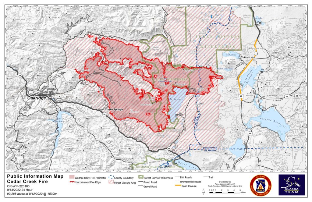
The Lane County Sheriff’s Office lowered evacuation levels yesterday, taking the entire Oakridge area from Level 3 (Go Now) to Level 2 (Get Set). Eastern Lane County, east of Waldo Lake and north of Waldo Lake Wilderness, and western Deschutes County remain at Level 3. Fire officials continue to work with local law enforcement to communicate fire conditions and keep the community safe. People with mobility limitations or smoke sensitivity are encouraged not to return to Level 2 areas. Those who choose to remain in shelters will continue to receive services provided by the Red Cross. Smoke continues to create unhealthy air quality, which will likely continue for several days. Smoke is now impacting communities on the east side of the fire, particularly La Pine, Crescent Lake, Sun River, and Bend.
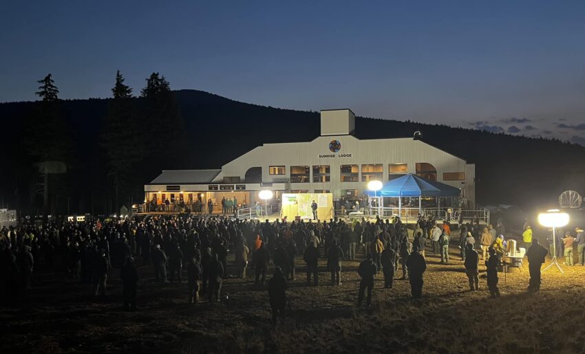
A virtual community meeting will be hosted by East Zone’s Alaska Team tonight at 7 p.m. on Facebook live. Join to learn more and have your questions answered.

West Zone Operations: Pacific Northwest Interagency Incident Management Team 3, led by Incident Commander Randy Johnson, assumed command of the West Zone at 6 a.m. The team continues to coordinate firefighting operations with the OSFM Red Team and the Alaska Incident Management Team managing the East Zone of the fire.
The fire remains active and crews engaged around the west Zone perimeter, improving fire lines along roads and constructing hand and equipment lines. As the sky cleared in the West Zone yesterday, air operations were able to fly reconnaissance missions to determine where fire growth occurred, verify containment lines, and look for opportunities to increase containment. The fire was actively burning and most active on the south side of Salmon Creek.
Today, firefighters continue to improve and prepare roads to be used as a containment line. The fire is backing down toward containment lines. Crews are preparing roads to be used as fire lines including Forest Roads 19, 2409, 5871, and 5853. The light precipitation had limited impact to fire behavior and crews are maintaining their momentum in suppression efforts during this window of opportunity.
The OSFM task forces continued to assess and prepare structures yesterday. This work included removing fuels and identifying hazards that can make fire suppression work difficult and dangerous. Because of the improved fire conditions, two task forces demobilized yesterday to return to their home fire districts. Five task forces from OSFM remain committed to the fire.
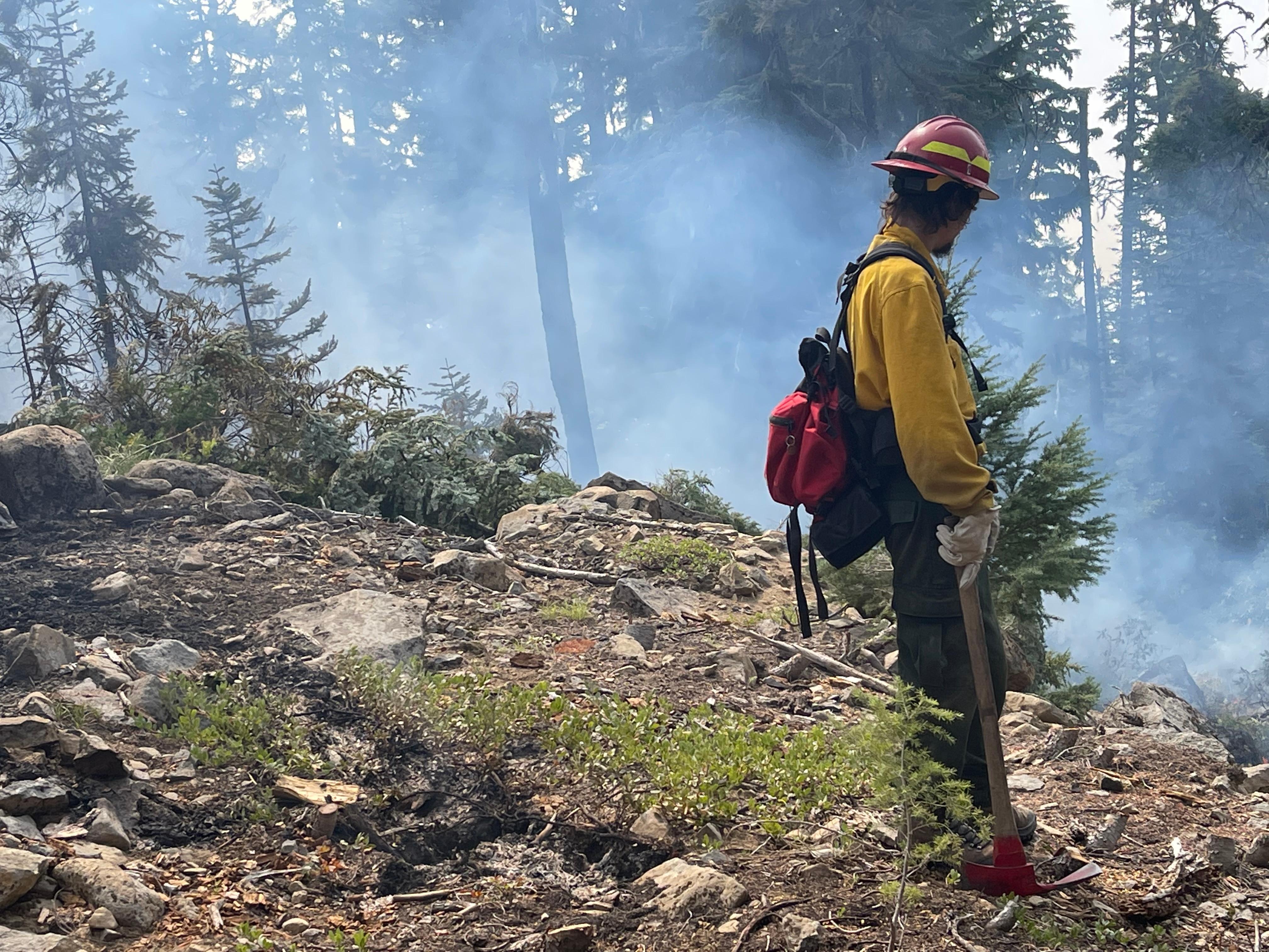
East Zone Operations: Operations focused on a containment strategy by strengthening existing or natural barriers. Fire crews removed fuels to create contingency line to protect communities, structures, and other values. The active fire edge with heavy fuels, high concentrations of snags, flammable lichens, and downed and dead trees is dangerous for firefighters. They engage directly on the fire when conditions are safe. Air operations assisted by dropping water or retardant to slow the fire’s progression. Recent heavy smoke grounded aircraft, but operations will resume as conditions allow.
Crews removed fuels along existing roads to improve them as a fire barrier. Along the west side of Cascade Lakes Highway, crews are using heavy equipment to remove vegetation to create a shaded fuel break. Most of the flammable vegetation is removed, but trees remain, distanced about 40 feet from each other. Crews are brushing forest roads to create a stronger barrier to potential fire spread. On the southeastern edge, Forest Road 5896 on the north side of Odell Lake, and Forest Road 4668 east to Davis Lake are being prepped. On the east edge, south of Little Cultus Lake, two miles were cleared along Forest Road 4290. An OSFM task force will conduct tactical patrols near Crescent Lake and coordinate with local fire resources.
Crews protected structures by clearing surrounding brush, laying hose and sprinklers, and sometimes wrapping structures like signs or historic structures to protect them from fire. Crews implemented structure protection along Cultus Lake, Lava Lake, Crane Prairie Reservoir, and Odell Lake, among others. These efforts will continue.
Weather/Fire Behavior: Scattered showers yesterday resulted in 2-3 hundredths inches of rain across the fire area. Relative humidity recovery was very good and the heavy smoke layer continued to moderate fire activity. Cooler daytime and nighttime temperatures are expected the next few days with light westerly winds. Fuels remain dry, especially downed and dead trees. Torching and spotting are expected, but most activity should be creeping and smoldering.
Evacuations: Sign up for emergency mobile alerts at oralert.gov. Please check with Lane County Sheriff’s Office at 541-682-4150 and Deschutes County Sheriff’s Office at 541-693-6911 for updates and changes. For a map, visit https://bit.ly/3D51kvC.
Closures: Please visit Willamette National Forest and Deschutes National Forest for closures and a map. A Temporary Flight Restriction (TFR) is in place and drones are prohibited in the fire area; please make it safe for our firefighters to use aircraft on the fire. Pacific Crest Trail hikers visit pcta.org for trail information.
Restrictions: Fire restrictions are in place in Willamette National Forest and Deschutes National Forest.
Smoke: Fire.airnow.gov, oakridgeair.org, and LRAPA – Today’s Current Air Quality
Smoke forecast: outlooks.wildlandfiresmoke.net/outlook
Inciweb: inciweb.nwcg.gov/incident/8307/
Facebook: facebook.com/CedarCreekFire2022/
YouTube: tinyurl.com/cedarcreekfireyoutube
Fire Information: 8 a.m. – 8 p.m. | Phone: 541-201-2335, Media Line: 541-327-9925 |
Email: 2022.cedarcreek@firenet.gov

