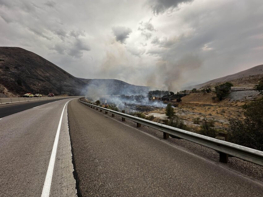
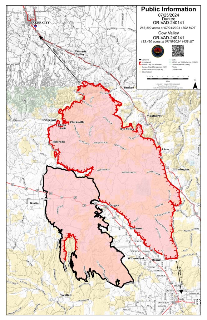
On Thursday, moderate fire behavior is expected on the Durkee Fire in northeast Oregon. Moderate post-frontal weather conditions are forecasted (including a slight drop in temperature, higher humidity, calmer winds, and a low probability of thunderstorms). Firefighters will seize the opportunity to employ direct strategy with handline, heavy equipment, and other means to continue their full suppression efforts.
Thursday’s fire operation priorities include containment in the Bridgeport, Shirttail Creek Road, and Rye Valley areas. Where firefighters were successful holding the fire edge in the I-84 corridor, mop up around structures is also a focus.
QUICK FACTS
Start date: July 17, 2024
Location: 5 miles southwest of Durkee, OR
Personnel: 514
OSFM Task Forces: 4
Fire size: 268,492 acres
Cause: Lightning
Containment: 0%
On Wednesday, gusty and erratic winds, lightning, and flash flood warnings were present. At higher elevations, red flag outflow winds brought on by back-to-back thunderstorms initially formed a southeast front with 45 mph gusts. Observed near Unity, winds increased to 66 mph. 55 mph gusts were seen throughout the night.
Although Wednesday’s weather conditions caused spot fires (also known as a slop-over) in many areas, firefighters saw a lot of success catching them. During the height of extreme fire behavior conditions and heavy gusts, one report noted a 30-acre slop-over across HWY 30 at 3:30 p.m. The Oregon State Fire Marshal and NW Team 6 operations acted in partnership with railroad operations to contain fire that threatened three structures.
Aerial resources will be coordinated and prioritized between the Badlands Complex, Durkee Fire, and Vale BLM going forward due to state-wide fires and resource availability.
Areas in the Durkee Fire footprint experienced up to ½ an inch of precipitation and reports of debris flows are expected. However, the north end of the Durkee Fire only saw 2/10 of an inch of rain, and fire behavior is still expected to be active in days to come across the Durkee Fire footprint. Be aware that hazardous air warnings are in place across the Durkee Fire footprint. For current smoke information, visit airnow.gov.
The Malheur County Sheriff’s Office and the Baker County Sheriff’s Office issued evacuations for multiple areas. Residents in Level 3 Evacuations “GO NOW”, should leave immediately. Residents should not return to their property until evacuation levels have been removed. Carry enough supplies to support you and your family for multiple

