Firefighters continue to make steady progress in establishing fire lines to protect the communities of the Illinois Valley and halt the spread of the Smith River Complex North.

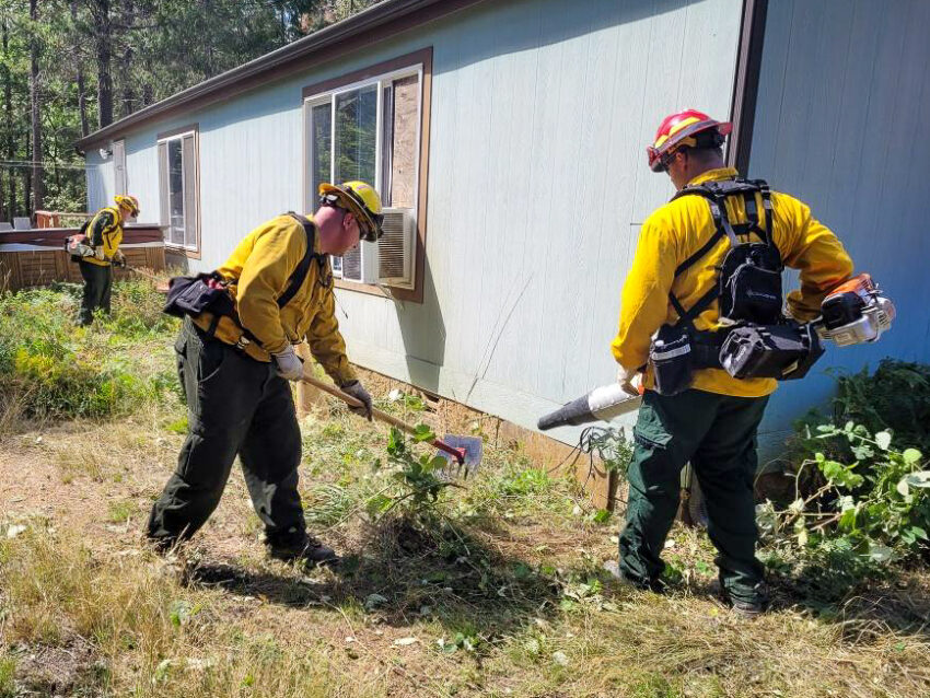
Oregon State Fire Marshal (OSFM) task forces continue to expand defensible space around threatened homes and other buildings, giving them added protection from firebrands or embers. Firebrands are small pieces of burning vegetation like small branches or leaves that can be carried across a fire line by the wind.
At night, the OSFM crews patrol the perimeter of the fires and watch for spotfires. When needed, they are also assisting wildland crews.
With aviation support and favorable winds, backburning is happening on day and night shifts. Backburning is essentially setting a smaller, controlled fire ahead of the main fire to eat up all the stuff the big wildfire would use to grow. It’s a way to stop the main wildfire or at least slow it down, giving firefighters a better chance to get it under control.
Winds out of the northeast have been pushing the fire back on itself for several days but are expected to shift again this weekend and come from the southwest. Cooler weather and measurable rain are also predicted this weekend, which may reduce fire activity but will not be enough to extinguish the fire.
QUICK FACTS
Start Date: August 15, 2023
Location: Wild Rivers Ranger District
Cause: Lightning
Acres: 79,053
Containment: 7%
Personnel: 3,053
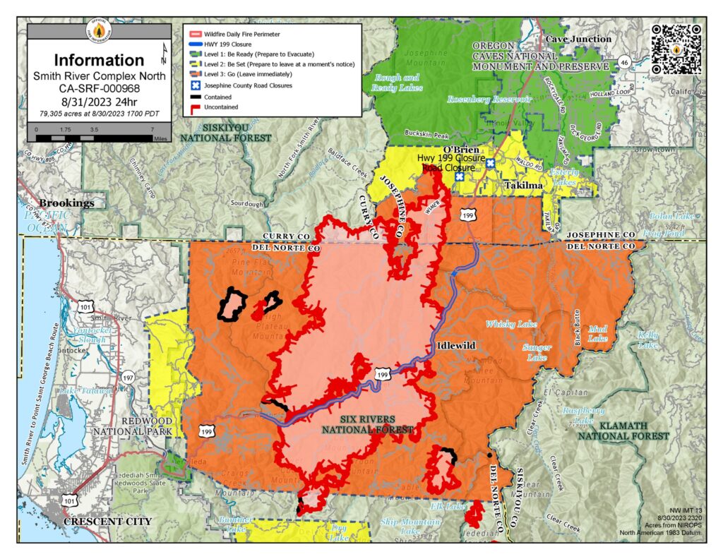
A Level 3 – GO NOW evacuation remains in place for the Hwy 199 area south of O’Brien from milepost 38 to the state line. A Level 2 – GET SET evacuation is in place for O’Brien and the Takilma area. A Level 1 – GET READY evacuation is in place north up to Cave Junction. An American Red Cross evacuation shelter is at Rogue Community College in Grants Pass. Livestock can be sheltered at the Josephine County Fairgrounds.
Because of fire activity, the public is encouraged to monitor the Rogue Valley Emergency Management site at https://rvem.org for evacuation updates. An interactive Fire First Response Map showing evacuation areas can also be found there.
Rogue River-Siskiyou National Forest has implemented an area and road closure order for the Smith River Complex. Visit the forest website for additional information at https://tinyurl.com/2s4hymku. The Bureau of Land Management Coos Bay District announced an emergency closure of public lands near the Oregon/California border. For additional information, visit https://www.blm.gov/orwafire.

