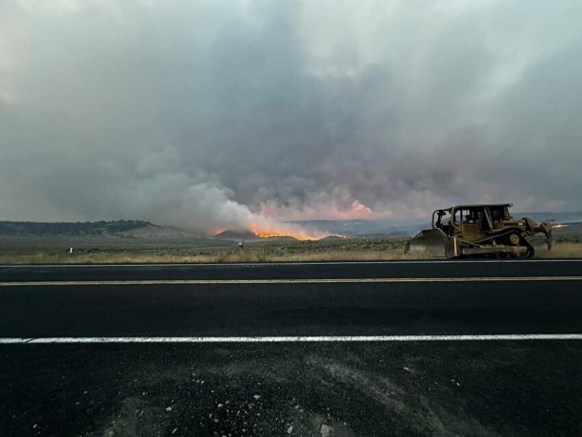
The Oregon State Fire Marshal’s Blue Incident Management Team arrived on the Rail Ridge Fire Friday evening and received a briefing. As of 6 a.m. Saturday, they are in unified command with California Team 10.
A Red Flag Warning is in effect Saturday until 9 p.m. because of the hot, dry, and unstable weather conditions. There is potential for thunderstorms overnight, and gusty, erratic winds combined with dry vegetation could result in another very active fire day.
Quick Facts
Cause: Lightning
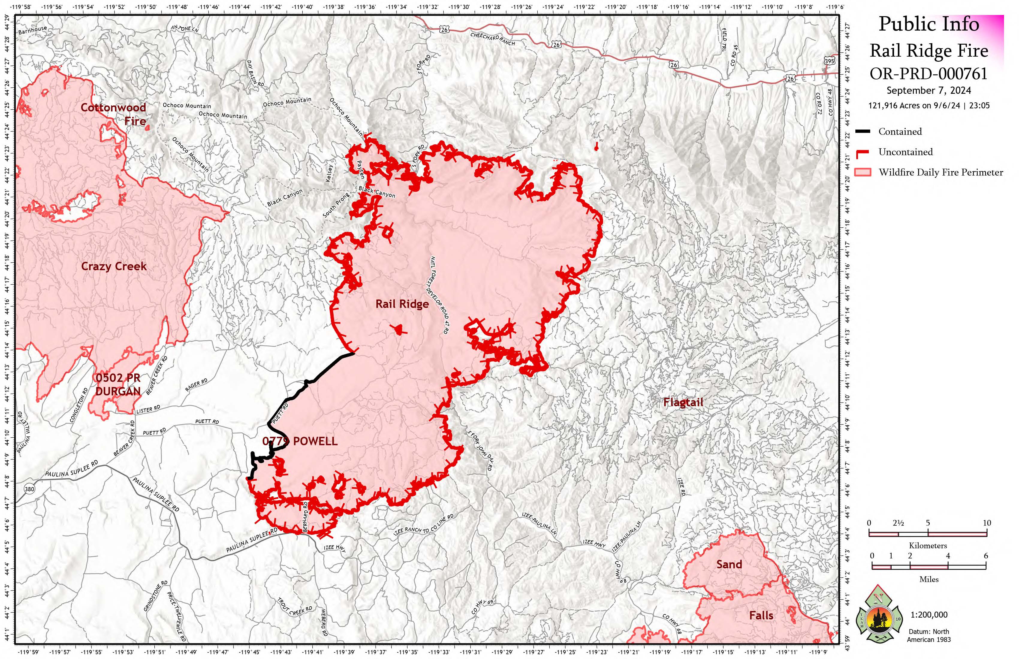
Acreage: 121,923 (Infrared flight from 9/6 11:05 p.m.)
Containment: 4%
The primary control objectives for the Rail Ridge Fire are to keep the fire contained south of Highway 26, east of Forest Service Road 12, north of County Road 308 (Paulina/Supplee Highway), and west of Laylock Creek (49/63C Road). These objectives may be adjusted based on changing conditions and available resources.
The fire remained highly active overnight Friday, driven by increased winds and extremely dry conditions. Night shift crews focused on protecting structures along the southern edge and maintaining existing containment lines around the perimeter, especially near private property and critical infrastructure. Crews also completed preparation work around the Aldrich Mountain Lookout to protect key infrastructure.
On Saturday, firefighters continue to strengthen direct and indirect fire lines around the perimeter. On the north end, structural crews are preparing structures near the fire line, while southern crews are prioritizing point protection and securing structures. Replacement OSFM task forces will arrive today to ensure 24-hour coverage for structure protection.
Hot, dry, and unstable conditions will persist through Sunday, with thunderstorms and stronger wind gusts expected overnight into Sunday morning. Critical fire weather conditions will remain until the weekend, with cooler temperatures and improved humidity recovery anticipated next week.
A public meeting about the Rail Ridge Fire will be held on Sunday, September 6, 2024, at 3:00 p.m. at the Dayville Community Hall. The meeting will not be live-streamed, but recorded presentations will be made available afterward.
For the latest updates, including current acreage, visit the Rail Ridge Fire information page at: https://linktr.ee/RailRidgeFire.
Closures and Evacuations:
- Portions of the Ochoco National Forest and BLM lands are closed for fire activity. Visit the Ochoco National Forest, Malheur National Forest, and BLM websites for more information and closure maps.
- For Crook County, visit the Crook County Emergency Management website or the Crook County Sheriff’s Office Facebook page for up-to-date evacuation information.
- For Wheeler County, check the Wheeler County Sheriff’s Office Facebook page.
- For Grant County, follow the Grant County Emergency Management Facebook page.
The primary control objectives for the Rail Ridge Fire are to keep the fire contained south of Highway 26, east of Forest Service Road 12, north of County Road 308 (Paulina/Supplee Highway), and west of Laylock Creek (49/63C Road). These objectives may be adjusted based on changing conditions and available resources.

