Firefighters worked through the night to protect the area between Rand and Galice, and aerial reconnaissance this morning confirmed no structures or homes were lost in those communities.
Additional resources were ordered, including leadership and operations of the Oregon Department of Forestry’s Incident Management Team 1, as the fire shifts to a unified command with the additional ODF-protected lands. In addition, an Oregon State Fire Marshal’s Incident Management Team and four structural task forces will be in unified command to protect life and structures.
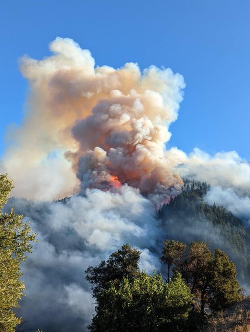
Late Friday afternoon, strong valley winds and hot temperatures fanned the fire near Grave Creek, increasing fire activity and throwing sparks out of the established perimeter to both sides of the river, which created spot fires that began making fast uphill runs. The increased fire intensity formed a pyrocumulus smoke column, which collapsed, pushing the fire to the south and east.
Cooler temperatures and higher humidity helped reduce fire intensity overnight, allowing ground resources to conduct various tactical suppression operations to protect Rand and Galice; however, protecting homes remains a top priority for firefighters. The Oregon Office of State Fire Marshal is mobilizing four task forces to protect life and structures.
Aerial and ground resources continue to build and reinforce direct and indirect lines and engage in the initial attack on spot fires, which were observed up to two miles from the fire footprint.
Evacuations: Josephine County Sheriff’s office issued a Level 3 – GO NOW evacuation from north of Belknap Gulch, Little Stratton Creek, south of Angora Road, Lower Grave Creek Road, east of the Rogue River, west of Tom East Creek, Hog Creek Road, Hog Creek; south and west of the Rogue River and north of Bear Camp Road; Rand, Galice, and Galice Creek Road.
A Level 2 – BE SET to evacuate is in place from north of Galice Road and the Rogue River, south of Lower Grave Creek Road, east of the Rogue River and Taylor Creek, and west of Hog Creek Road.
A Level, 1 – BE READY notice, was issued for north and west of Brimstone, south of Lower Grave Creek Road, east of Lower Grave Creek Road and Angora Road and south and west of the Rogue River, and north of Bear Camp Road; includes Rand, Galice, and Galice Creek Road.
For current evacuation information and resources, visit facebook.com/josephinecountyEM or Josephine County Incident Information (rvem.org)
River Status: The Rogue River is temporarily closed to boating from Hog Creek through the wild section to allow firefighter resources to operate freely. Rangers are stationed at Hog Creek boat launch to prevent boaters from putting in and on the ramp to direct boaters off the water.
Closures: Medford Bureau of Land Management will issue an updated closure order later today, which will be posted at https://inciweb.nwcg.gov/incident/8348/ and facebook.com/rumcreekfire2022.
Safety: Please do not use Galice Road south of Racetrack unless absolutely necessary to allow free movement of fire and emergency resources.
