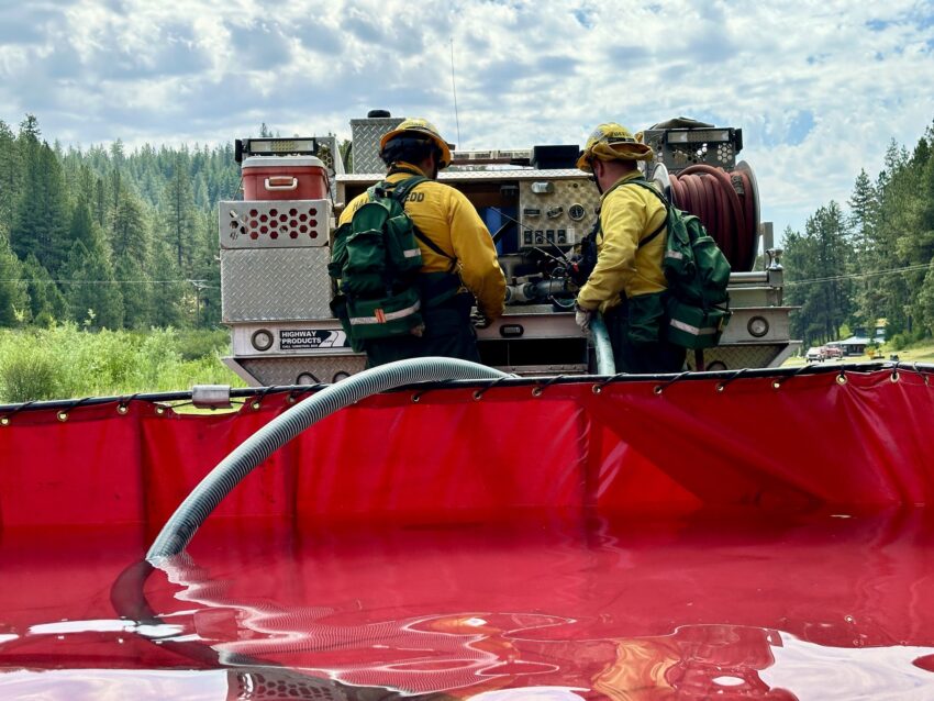
The Lone Rock Fire is being managed under a full suppression strategy by the unified command of the Northwest Team 2 and Oregon State Fire Marshal Red Team.
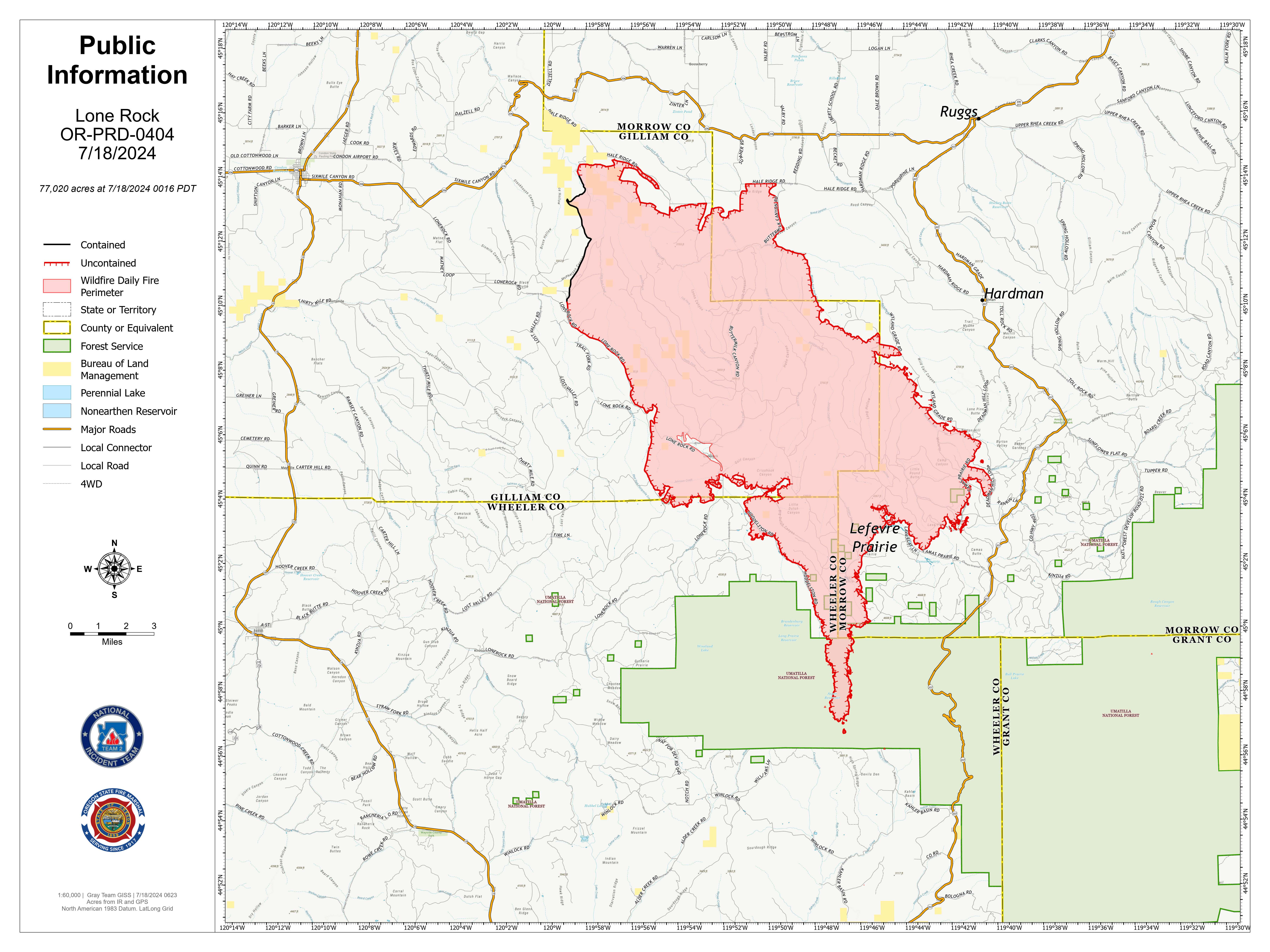
Significant fire behavior happened Wednesday afternoon, leading to notable fire growth to the south. The fire’s southward growth into timber fuels increases the likelihood of crown fires and long-range spotting. In the northwest area of the fire, firefighters made progress securing the fire line. Wednesday night, the fire remained highly active in the southern area, crossing Forest Service Road 21. Firefighters continued to hold the fire north of Forest Service Road 25. Firefighters worked through the night providing structure protection to the surrounding communities.
QUICK FACTS
Location: 10 miles SE of Condon, Oregon
Size: 77, 020 acres
Containment: 10%
Cause: Under Investigation
Start Date: July 13, 2024
Total Personnel: 607
InciWeb: Lone Rock Fire
Facebook: Lone Rock Fire Information
The Oregon State Fire Marshal resources worked to mop up lines and further secure the community of Lonerock. Crews also worked to access and protect structures on the southern flank of the fire, as activity picked up in the afternoon.
Firefighters are prepared to encounter increased fire behavior Thursday afternoon. Wildland fire crews will continue to monitor, patrol, and secure the north and northwest area. Thursday the remaining six structural task forces will be boosted by a complement of 20 engines that are assigned to the Lone Rock Fire. Structural crews will be working in the community of Lonerock, and along the 25 Road on the southern front of the fire.
Firefighters will work through the night to protect structures and suppress the fire, focusing additional resources on the more active southeastern area.
Evacuations
- Level-3 Evacuations – GO NOW! Level-3 Evacuate immediately for the following areas:
- Gilliam County: residences South of Lonerock. An evacuation center is set up at memorial hall in Condon. For more information on evacuations, visit Gilliam County Sheriff’s Office Facebook page
- Morrow County: from the West County Line along Buttermilk Canyon to HWY 207, Mile Post 10 South of Hardman to the South Morrow County line. The Red Cross will be setting up a temporary shelter at the Heppner Elementary School. For more information on evacuations, visit Morrow County Sheriff’s Office Facebook page
- Level-2 Emergency Alert – GET SET! Level-2 Be set to evacuate at a moment’s notice for the following areas:
- Gilliam County: residences North of Lonerock.
- Wheeler County: community of Spray. A temporary evacuation center has been set up at the Wheeler County Fairgrounds (720 E 3rd Street in Fossil, OR). Showers and public restrooms are available on site. For more information about the evacuation point, call 2-1-1.
Hot, dry conditions are expected to persist. The southwest morning winds are expected to shift to northwest gusting winds this afternoon. This will contribute to very active fire behavior in the afternoon.
Smoke Information
Visit https://fire.airnow.gov/ for local air quality information.
Flight Restrictions
A Temporary Flight Restriction (TFR) is in place above the Lone Rock Fire area. If you fly, we can’t. Unauthorized drone flights (UAS) pose serious risks to firefighter and public safety and the effectiveness of wildfire suppression operations. Aerial firefighting is suspended when unauthorized UAS are in the area, allowing wildfires to grow larger.

